-

This drawing of London Bridge by Stephen Conlin depicts the middle section of the bridge as it may have appeared in 1590. Visible in this drawing is not only the outside structure of the bridge, but some interior scenes as well. At the bottom of the bridge are the piers and oblong-shaped starlings, which provided support for the roadway and buildings. Unlike most medieval bridges, the piers of London Bridge extended about fifteen feet from the roadway. As a result, the homes built on London Bridge rested largely on the piers, with added support provided by large hammer beams, visible between the piers in the drawing. In the center of Conlin’s drawing, the pier foundations of several homes are visible. Homes that were located directly over the piers could have cellars; another feature highlighted in this reconstruction. The rooms at street level were used as shops since the bridge was first and foremost a commercial area. ‘Solars’ or private rooms were located on the upper floors. In this drawing the buildings have four stories, which would have been common in 1590. For the majority of the medieval period, however, the buildings on the bridge would likely have had two stories.
-

This drawing by Pete Urmston illustrates what the roadway of London Bridge might have looked like in 1600. Positioned in the center of the image is what is known as a ‘cross-building,’ which were connecting structures built between houses on either side of the street. References to such structures were recorded as early as the mid 14th century, although they were called by a different name. In the rent records of 1358, the structure used to connect two buildings over the roadway was known as a ‘hautpas’ or high place. These structures were used to provide additional support for the bridge’s buildings, which were frequently subjected to high winds. However, the cross-buildings also presented several disadvantages by obstructing sunlight and, at a height of around 10 feet, making the roadway appear more congested. Despite these drawbacks, real estate on the bridge remained extremely popular. Those who ran the street-level shops located on the bridge also lived on the upper floors of the buildings. During the 14th and 15th centuries, the dominant trades of the bridge were haberdashers, glovers, cutlers (who made or sold edged weapons and tools), bowyers (bow makers), and fletchers (arrow makers). Sellers, more often than manufacturers, were willing to pay the high rents on London Bridge in order to take advantage of access to one of the most prominent shopping areas in the city. Based on the descriptions of leases granted during the medieval period, commerce on London Bridge was geared more towards specialty goods rather than daily purchases although there was a notable lack of such luxury crafts as goldsmiths and jewelers.
-

This drawing by Stephen Conlin presents a view of London Bridge similar to that shown in London Bridge c. 1250, although the perspective of this drawing is from the southeast rather than the southwest.
-

This drawing by Pete Urmston shows London Bridge as it might have appeared in 1250. The perspective of the drawing is from Southwark, on the south bank of the Thames, looking north towards the city of London. Visible in the center of the drawing is one of the bridge’s stone gates and its drawbridge, which is raised to allow ships to pass underneath. The larger building beyond the gate is the chapel of St. Thomas the Martyr. Surrounding these structures are the many shops and private dwellings that lined both sides of the bridge. The original layout allowed for 124 plots that were around 10 ft in width, not counting the homes adjoining the drawbridge tower and the gates. There was a disparity between the lengths of the buildings on the eastern and western sides due to the roadway being slightly off-center on the northern end of the bridge. On the east side, the buildings were 18 ft deep, while on the west side they were 26 ft deep. Although seemingly tight for such a busy thoroughfare, records indicate that plots in Cheapside, London’s main shopping area during the period, ranged from only 6 to 7 feet wide. In less trafficked areas of London, shops could be much larger, but the size of the shops on London Bridge are another indicator of the area’s desirability as a commercial district.
-

This drawing by Peter Jackson depicts the methods used to construct the first stone London Bridge in 1176. The builders created enclosures at low tide, which they then filled with debris to act as the base of each pier (visible to left in the drawing). Planks were laid across the tops of these piles, so the builders had a surface from which to construct the starlings, which were wooden-faced pilings that eased the impact of the river on the bridge's piers. In total, the bridge had nineteen arches, and nineteen piers, which supported the structures on top. The starlings required constant upkeep, made possible by the revenue generated from the many properties held by the Bridge in the city. In its over six hundred years of use, the Bridge suffered only two collapses, five arches in 1281 and two in 1437. The timber bridge visible in the background reflects the now disproven notion that the earlier timber bridge was located further east of the stone bridge.
-

-
-
-
-

-

-
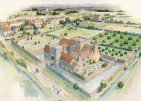
This reconstruction drawing by Alan Sorrell depicts Jewel Tower as it would have appeared in the late 15th, early 16th centuries. In the image, Jewel Tower is the L-shaped building located in the center of the drawing. The large, buttressed building in the background is Westminster Abbey. Between the two buildings is the Palace of Westminster, also known as the Privy Palace. The Privy Palace acted as the main residence of the royal family from the 11th century to the 16th century. Jewel Tower was constructed in 1365-66 as a treasury of Edward III’s personal valuables. The tower was built at the western end of the royal garden, south of the Palace of Westminster. The land where the tower was constructed had originally belonged to the monks of Westminster Abbey, who were reportedly very disgruntled at losing their land to the king.
Due to the valuables stored inside, Jewel Tower was designed for security. As seen in the drawing, the tower was surrounded by a moat on three sides, which provided an added measure of protection. The first floor of the tower had no windows facing outside of the enclosure. The top floor is believed to have been the storeroom for the precious objects based on its two-door entrance. Today, the Jewel Tower is one of only a handful of surviving London buildings from the medieval era. Small alterations and repairs have been made throughout its lifespan, including after its roof was destroyed during a bombing in 1941. Overall, the building remains almost exactly as it would have been during the 14th century. Often overlooked because of its size, and the surrounding buildings, Jewel Tower is only now becoming the subject of both historical and architectural scholarship.
-
Karen Guffogg’s reconstruction drawing of Blackfriars ship 3 depicts how the boat, which was uncovered by London archaeologists in 1970, would have appeared in 1400. The wreck was located to the west of Trig Lane, near Blackfriars. This type of broad, flat-bottomed boat was capable of carrying heavy loads while sailing in shallow water. Although it is not known exactly what kind of cargo would have been transported by this vessel, the lack of ceiling planks indicates that it did not carry stone, as they would have damaged the planks on the bottom of the boat. Boats of this construction were able to sail on the Thames and its nearby tributaries but were unsuitable for seafaring due to their smaller size. Close by to the wreck of Blackfriars ship 3, is another vessel known as Blackfriars ship 4. Due to the short distance, and similar leveling in the riverbed, it is believed the two boats may have sank after a collision, an indication of the congestion of shipping boats on the Thames.
London’s position on the river Thames was of the utmost importance for its growth as a city because of the access it gave inland London to the English Channel and overseas markets. The city’s thriving economy was based on a variety of industries, including the cloth trade, wine imports, and the fish market. Trig lane, where the Blackfriars 3 boat was found, was originally known as Fishing Wharf Lane. Fishing was a crucial aspect of the diet of Londoners, and around 1,000 lead fishing sinkers were found buried with Blackfriars 3. The Thames also served important daily functions for the inhabitants of London such as gathering drinking water, washing, and using public latrines. During the 12th century, however, the riverfront of the Thames steadily became more privatized than it had been in the past. Urban growth on the riverfront led to the construction of multi-story buildings for commercial, residential, and industrial purposes.
-
This vivid illustration by Terry Ball depicts Wakefield Tower as it may have appeared during the 14th century. Originally known as Blundeville Tower, when it was constructed between 1220 and 1240, Wakefield Tower is located on the side of the compound closest to the Thames, attached to what is known as Traitor’s Gate, by a wall with a portcullis beneath it. The tower was intended to serve as a bedchamber for King Henry III. Following the accession of his son Edward I, the tower was no longer used as a private bedchamber as the king chose to stay in the Tower of St. Thomas. As shown in the reconstruction drawing, the interior of the tower, like many other rooms at the Tower of London, was richly painted in vibrant colors. The screened area at the center of the drawing was a small chapel for use by the king. The throne to the left indicates that the room may have been used as a private reception room, once it was no longer a bedchamber.
Like many other sites at the Tower of London, Wakefield Tower is most well-known for a violent altercation. The tower was the site of the murder of king Henry VI, which was ordered by Edward IV. In 1471, Edward’s forces defeated those of Henry VI, who was kept as a prisoner in the Tower of London. In May of the same year, Henry was praying at the small chapel in Wakefield Tower when he was struck in the head and killed. Today, Wakefield Tower is open to visitors at the Tower of London. The current chamber largely resembles the drawing, with the most notable change being the lack of decoration on the walls and ceiling.
-

This drawing of London Bridge by Peter Jackson depicts a busy street scene on London Bridge. The river crossing occupied by London Bridge had been utilized by London’s inhabitants since Roman times. The use of stone in bridge construction first occurred during the reconstruction of the bridge in 1176 and was overseen by Peter, chaplain of the nearby Colechurch parish. Houses and shops were built on the bridge early on, but, living on the bridge was not without its dangers. In 1212 a major fire swept across the bridge destroying many of the homes and part of the Chapel of St. Thomas and there were also several instances of the arches of the bridge collapsing. Rents from properties on the bridge and elsewhere in the city, as well as tolls on ships and carts passing under and over the bridge, paid for the near constant upkeep of the bridge structure. The income was recorded in the accounts of the Bridge House estate, whose accounts also show payments to a group of workers known as ‘tidemen,’ who were responsible for the upkeep of the bridge, as well as for materials such as the frequent shipments of stone they received to make repairs.
Bridges in medieval cities served as important commercial and residential thoroughfares; the first floors of the buildings served as shops, while the upper levels were homes. The buildings situated on the bridge were some of the most expensive real estate in the city. London’s inhabitants recognized that the funneling of pedestrians through the bridge created the perfect location for commerce. Those crossing the bridge, whether on foot or by horse, had to pay a toll, while those moving goods paid an additional fee. A survey of rents from 1358 reveals that there were sixty-two shops located on the east side and sixty-nine shops located on the west side of the bridge. The structure of these buildings was so compact, the bridge was described as appearing like a continuation of the street rather than a bridge. The commercial congestion of the bridge is clear in Jackson’s work, the crowds of shoppers and condensed buildings appear like any other street in London, but the sliver of blue water beyond the bridge’s railing at the back of the drawing reminds the viewer that they are looking at London Bridge.
-
-

This drawing by Peter Jackson depicts the Chapel of St. Thomas on London Bridge as it would have appeared in the late 14th century. The chapel was constructed on the London Bridge in the late 12th century on the largest central pier. During this period, the idea of public works as acts of piety became popular. It was believed that building chapels on bridges would ensure their protection. Dredging of the Thames beneath has revealed countless discarded pilgrimage badges depicting St. Thomas Becket, leading many scholars to believe that the chapel may have been the starting point for various pilgrimages. The Chapel of St. Thomas was built in commemoration of Thomas Becket, archbishop of Canterbury, who was murdered in 1170 under the direction of Henry II. As penance for Becket’s murder, Henry II was forced to sponsor for the construction of a new stone bridge for the city of London.
Construction began in 1176 with the foundations of the first pier. The project was overseen by Peter of Colechurch, a parish priest who supervised the project for twenty-nine years. Ultimately, the process took thirty-three years and was completed in 1209. Peter of Colechurch died in 1205, four years before the bridge was completed, but the chapel was able to receive his remains. The chapel was maintained by the bridge wardens who were in charge of dispersing money for its upkeep, while several chaplains also attended to the running of the chapel. Daily mass was offered, as were seasonal observances, including the feast day of St. Thomas the Martyr on the 29th of December. From 1384-96 the chapel was rebuilt in the perpendicular style, a late medieval form of the gothic style that emphasized rich decoration. The new building was a five-sided, east-facing apsidal end over an undercroft/lower chapel. In this drawing, the large stained glass windows and decorative tracery can be observed as elements of the perpendicular style.
-
-
This drawing depicts Stepney Manor as it would have appeared in the 15th century. Built in the east end of the city as one of the residences for the bishop of London, many early records of Stepney shed light on the general management of the building and its grounds. Within the structure of the building, there were separate chambers for the bishop and his clerks connected by an ambulatory (a covered open-air passage), as well as a chapel which was added by 1243. Documents from 1363 detail the tiling of the kitchen, bakery, bishop’s chamber, and an unspecified outside chamber. There are frequent mentions of daubing and plastering the walls of various areas of the building, demonstrating the amount of work and materials required to properly care for such a large home.
Like most manors of the Middle Ages, Stepney was largely self-sufficient. Within the compound were stables, a carriage house, and thatched granges for storing wheat, barley, and rye. The great garden and the smaller kitchen garden provided reeds for thatching other buildings on the property. Records indicate the existence of a dovecot, a structure used to house doves or pigeons, which were an important food source for the land-owning elite during the medieval period. This drawing by Faith Vardy depicts Stepney Manor after it was renovated in the 15th century. The new manor was brick-built with a courtyard and a surrounding moat encircled by brick walls. The entrance to the manor was accessible through the gatehouse called King John’s Tower. In 1597, the manor was purchased by Henry Somerset, fifth Earl of Worcester and renamed Worcester House. During the English Civil War parliament seized the property from the earl. Subsequently, the manor was turned into a Baptist College in the 1830s. After the College moved in the late 19th century, most of the buildings on the property were demolished and there are no visible remains of Stepney Manor in London today.
-
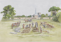
This drawing of Charterhouse Cemetery by Faith Vardy depicts the cemetery as it may have appeared in the 14th century during the Black Death plague that swept through London in 1348. In the background of the scene, the church of St. Bartholomew's Priory is visible, as is the spire of medieval St. Paul's. The graveyard was uncovered during digging for the City of London’s ambitious Crossrail railway project in 2013. Prior to this discovery, there was some speculation that an undiscovered plague burial site was located somewhere around Charterhouse. Eleven skeletons were recovered at the phase I site of the cemetery, including the bodies of nine adults, one adolescent, and one child. Each of the bodies were laid in rows with their heads facing south-west. Between each grave was enough room for a person to walk, indicating a level of care on the part of the gravediggers. The site is one of several cemeteries dating from the medieval period to the 1700s that were discovered during excavations for the Crossrail.
The Charterhouse itself was a Carthusian Monastery established outside the walls of the City of London in 1371. Some records indicate that the location of the monastery may have been chosen because of the proximity to the plague burial site. The accumulation of land for the monastery occurred piece by piece, over the course of several decades and the last buildings were only completed in 1450. At its founding, there was anxiety among the lay people regarding access to the cemetery that had been created during the plague in 1348. However, the monastery allowed the funerals of lay people to occur in the church and for the laity to visit the cemetery located on the grounds. Unusually, the Charterhouse monks each had their own living quarters; they also gained a reputation for their spiritual and intellectual activities, though like other monastic houses they were dissolved on the eve of the English Reformation in 1538.
-
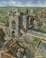
This drawing by Peter Jackson illustrates one of medieval London’s seven gates in the city wall, which dates from Roman times. During the reign of Henry II, seven double gates were added to better protect the city. Jackson’s drawing depicts the gate as much larger than it actually would have been. The image was created for use in the children’s historical magazine Look and Learn, which may explain why the proportions of the gate itself are exaggerated. In the drawing, the gate appears to rise several stories above the city wall. In reality however, the gates were only about one story taller than the wall itself. The small stream flowing underneath the gate depicted in the drawing is not entirely accurate either. Defensive ditches were dug around the perimeter of the wall, but they were not filled with water. In areas close to the Walbrook river the marshes could provide natural defenses, but the ditches were typically kept dry, although they frequently filled with silt and other debris. Other details of the picture, such as the crenelations of the wall, are accurate to contemporary maps of medieval London.
-
-
-
This drawing by reconstruction artist Terry Ball depicts London’s Guildhall as it would have appeared in the 15th century. The Guildhall acted as the seat of civic power in London during the medieval period. In the 15th century, there was a campaign of civic improvements led by London’s mayor Richard Whittington (c. 1354-1423), of which the Guildhall was the centerpiece. The campaign lasted from 1411 to 1450 and saw the expansion of the Guildhall to become the largest secular hall in London. The impressive building contained two courts, one for the Mayor and one for the meeting of the city’s Aldermen, a chapel, and the Guildhall library. The Guildhall acted as a sort of palace for the Mayor, an indicator of his immense power in the city. Second to the king, the Mayor was the most important man in London. The Guildhall acted as a focal point of civic proceedings. During special city holidays, the Mayor, Aldermen, and Sheriffs conducted processions from the Guildhall to St. Paul’s cathedral, then back to the Guildhall. Through public displays such as these, London officials cemented the Guildhall as a place of civic power for the inhabitants of London.
In addition to civic proceedings, the Guildhall served an important economic function. One of the halls in the precinct was used as a market for wool, England’s main export at the time. London’s merchants were keenly aware that centers of trade in cities acted as cultural symbols for foreign merchants. Trading centers on the continent such as Flanders and Bruges had spectacular civic halls, which London merchants would have seen during their travels. Not only did they act as commercial hubs, these halls also demonstrated the wealth and prestige of the entire city. The enormous great hall designed by stone mason John Croxtone was based on the great hall of Westminster palace, built in 1097 by William Rufus and redesigned by Richard II in the late 14th century. The palace was famed for its large, ornate great hall, which boasted a beautiful hammerbeam roof and gothic style windows. The Guildhall’s own gothic architecture reflected the desire of London’s civic leaders to establish the city as a center of European influence.
-
A drawing of Windsor Castle as it may have appeared in 1090.
